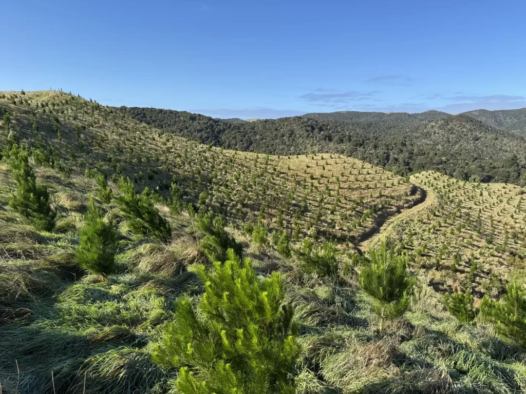
We integrate satellite imagery, drone survey, LiDAR technology and field measurement with state-of-the-art AI and computer vision algorithms to deliver comprehensive forest inventory analytics. Our team brings both deep technical capabilities and practical forest management experience, providing solutions that meet the needs of precision forest management and support data-driven decision making.
Services
Forest Stocking and Area Verification
We specialise in processing imagery, LiDAR, and multispectral datasets to deliver accurate, tailored spatial data verification that underpins your forest valuation and investment decisions. Our AI-driven analytics automatically flag mapping discrepancies, such as out-of-boundary planting, unstocked gaps and unidentified windthrow events. Depends on data source availability, we can also provide stand-level metrics such as stem counts and vegetation health indices (e.g., NDVI).
LiDAR Based Inventory
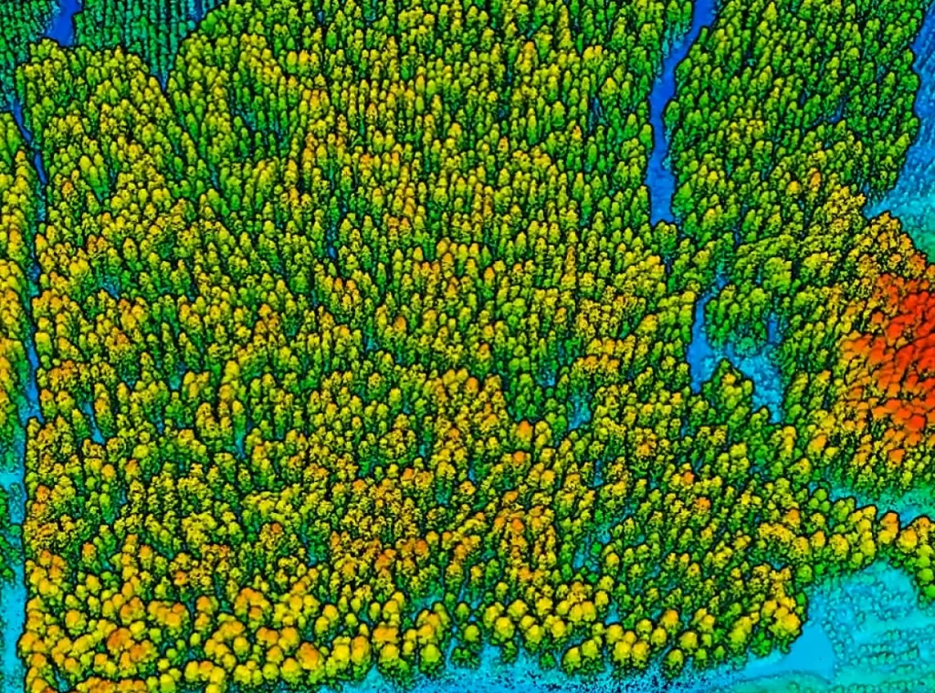
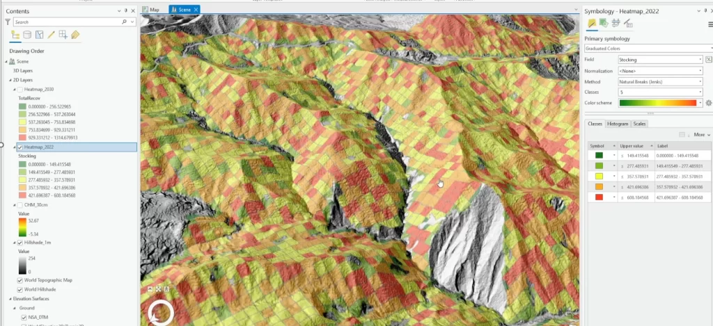
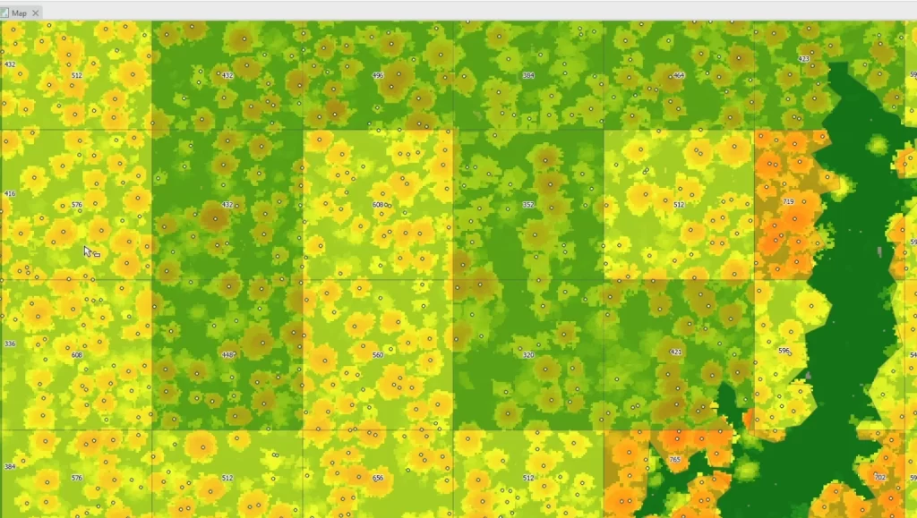
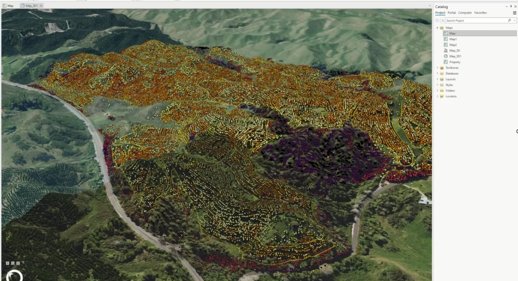
Our LiDAR-based inventory service provides solutions covering the entire project lifecycle, from initial data acquisition through final delivery and stakeholder communication. We begin with specifying LiDAR capture parameters and designing optimised field measurement plots to ensure the accuracy and efficiency. Through robust scientific processing methods, we delineate individual trees from the LiDAR data. We combine this information with ground measurements to calculate forest metrics – from individual tree heights and stem diameters to stand-level attributes like stocking and total recoverable volume. We deliver the results in several useful formats:
Point layer with single tree’s biometric properties
Visual heat maps displaying forest characteristics to help with planning
Digital Terrain Models that include extracted roads and streams
Technical reports with volume estimates, growth modelling and quality checks
Interactive dashboards that make it easy to explore and share the data with your team
Forest GIS and Data Services
We design and maintain enterprise geodatabases that integrate stand records, operation data, legacy shapefiles, drone imagery, etc. into a single source of truth. We deliver mobile mapping solution that let you capture and update spatial information in the field. We develop interactive forms that audit and track field operation, automate reporting, and integrate seamlessly with your existing GIS. Results are delivered through cloud-hosted web maps, mobile field apps, and BI dashboards—giving planners, contractors, and investors instant access to the insights they need.
Why Choose Us
Multi-Source Data Approach
We work with clients to develop the optimal data acquisition plan that meets their specifications and budgets – from publicly available satellite imagery, LiDAR and existing inventory data to high-resolution drone and LiDAR surveys – to balance detail, speed, and cost-effectiveness.
AI-Driven Analytics
Our analytics pipeline employs state-of-the-art AI and computer vision techniques to extract multiple metrics from remote sensing data. We can efficiently measure attributes such as stocking, diameter at breast height (DBH), tree heights, basal area and species composition at scale. We deliver insights that are more consistent and comprehensive that goes beyond what conventional plot-based inventory can provide.
Practical, Solution-Focused Approach
Our team has hands-on experience in forest operations, resource planning, and investment analysis. We blend technical expertise with deep industry knowledge to deliver efficient solutions to real-world challenges.
Project Delivery to Optimise User Experience
We understand that user experience is crucial to project success. We provide deliverables in multiple formats—GIS layers, technical reports, interactive maps, and dashboards with customised templates. These options let clients integrate our outputs directly into their workflows. Clear data visualisations also make it simple to communicate insights to stakeholders.
Client We Worked With
Get in touch for a complimentary consultation
Tell us about your project and discover how we can elevate your strategy.